|
|
 |
Tropical Cyclone Activity
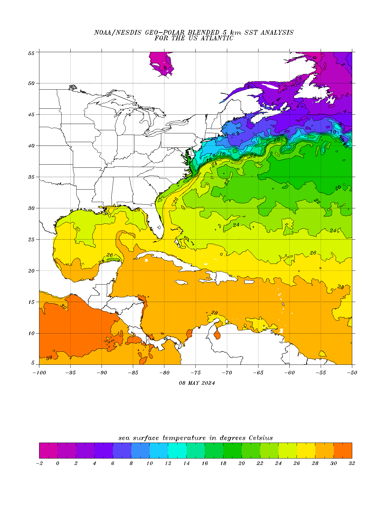
Tropical Sea Temperatures

Current Atlantic Satellite Image

Atlantic/Gulf of Mexico/Caribbean
Active tropical cyclones in the Atlantic, Caribbean, and the Gulf of America
Atlantic Tropical Weather Outlook
ABNT20 KNHC 052313
TWOAT

Tropical Weather Outlook
NWS National Hurricane Center Miami FL
800 PM EDT Sat Jul 5 2025

For the North Atlantic...Caribbean Sea and the Gulf of America:

Active Systems:
The National Hurricane Center is issuing advisories on Tropical
Storm Chantal, located off the coast of the southeastern United
States.

Tropical cyclone formation is not expected during the next 7 days.

$$
Forecaster Hagen]]>
Tropical Storm Tropical
-
Summary for Tropical Storm Chantal (AT3/AL032025)
...RAINBANDS FROM CHANTAL MOVING OVER THE CAROLINA COAST... As of 8:00 PM EDT Sat Jul 05 the center of Chantal was located near 32.3, -78.7 with movement N at 7 mph. The minimum central pressure was 1006 mb with maximum sustained winds of about 45 mph.
Tropical Storm Chantal
-
Tropical Storm Chantal Public Advisory Number 5a
Issued at 800 PM EDT Sat Jul 05 2025 000
WTNT33 KNHC 052342
TCPAT3
BULLETIN
Tropical Storm Chantal Intermediate Advisory Number 5A
NWS National Hurricane Center Miami FL AL032025
800 PM EDT Sat Jul 05 2025
...RAINBANDS FROM CHANTAL MOVING OVER THE CAROLINA COAST...
SUMMARY OF 800 PM EDT...0000 UTC...INFORMATION
----------------------------------------------
LOCATION...32.3N 78.7W
ABOUT 80 MI...125 KM ESE OF CHARLESTON SOUTH CAROLINA
ABOUT 140 MI...225 KM SSW OF WILMINGTON NORTH CAROLINA
MAXIMUM SUSTAINED WINDS...45 MPH...75 KM/H
PRESENT MOVEMENT...N OR 360 DEGREES AT 7 MPH...11 KM/H
MINIMUM CENTRAL PRESSURE...1006 MB...29.71 INCHES
WATCHES AND WARNINGS
--------------------
CHANGES WITH THIS ADVISORY:
None.
SUMMARY OF WATCHES AND WARNINGS IN EFFECT:
A Tropical Storm Warning is in effect for...
* South Santee River, SC to Surf City, NC
A Tropical Storm Watch is in effect for...
* Edisto Beach to South Santee River, SC
A Tropical Storm Warning means that tropical storm conditions are
expected somewhere within the warning area, in this case within
the next 12 hours
A Tropical Storm Watch means that tropical storm conditions are
possible within the watch area, in this case within the next 12
hours.
Interests elsewhere along the southeast coast of the United States
should monitor the progress of Chantal.
For storm information specific to your area, including possible
inland watches and warnings, please monitor products issued by your
local National Weather Service forecast office.
DISCUSSION AND OUTLOOK
----------------------
At 800 PM EDT (0000 UTC), the center of Tropical Storm Chantal was
located near latitude 32.3 North, longitude 78.7 West. Chantal is
moving toward the north near 7 mph (11 km/h). A motion toward the
north-northwest is expected to begin this evening, followed by a
turn to the northeast by Sunday night. On the forecast track, the
center of Chantal is expected to move across the coast of South
Carolina overnight or early Sunday morning.
Maximum sustained winds are near 45 mph (75 km/h) with higher
gusts. Some slight strengthening is forecast before Chantal reaches
the coast. Rapid weakening is expected after landfall.
Tropical-storm-force winds extend outward up to 140 miles (220 km)
primarily to the east of the center.
The estimated minimum central pressure is 1006 mb (29.71 inches).
HAZARDS AFFECTING LAND
----------------------
Key messages for Tropical Storm Chantal can be found in the
Tropical Cyclone Discussion under AWIPS header MIATCDAT3 and WMO
header WTNT43 KNHC.
WIND: Tropical storm conditions are expected in the warning area
beginning this evening and continuing through Sunday morning.
Tropical storm conditions are possible in the watch area this
evening and overnight.
RAINFALL: Tropical Storm Chantal is expected to produce heavy
rainfall across portions of the Carolinas through Monday. Storm
total rainfall of 2 to 4 inches, with local amounts up to 6 inches,
is expected. This rainfall will result in an elevated risk for
flash flooding.
For a complete depiction of forecast rainfall and flash flooding
associated with Tropical Storm Chantal, please see the National
Weather Service Storm Total Rainfall Graphic, available at
hurricanes.gov/graphics_at3.shtml?rainqpf
STORM SURGE: The combination of storm surge and tide will cause
normally dry areas near the coast to be flooded by rising waters
moving inland from the shoreline. The water could reach the
following heights above ground somewhere in the indicated areas if
the peak surge occurs at the time of high tide...
Edisto Beach, SC to Surf City, NC...1-2 ft
For a complete depiction of areas at risk of storm surge
inundation, please see the National Weather Service Peak
Storm Surge Graphic, available at
hurricanes.gov/graphics_at5.shtml?peakSurge
TORNADOES: Isolated tornadoes are possible tonight and Sunday across
parts of eastern South Carolina and eastern North Carolina.
SURF: Chantal is expected to bring life-threatening surf and rip
currents to portions of the coast from northeastern Florida to
the Mid-Atlantic states during the next day or so.
A depiction of rip current risk for the United States can be found
at: hurricanes.gov/refresh/graphics_at3+shtml/?ripCurrents
NEXT ADVISORY
-------------
Next complete advisory at 1100 PM EDT.
$$
Forecaster Blake]]>
-
Tropical Storm Chantal Forecast Advisory Number 5
Issued at 2100 UTC SAT JUL 05 2025 685
WTNT23 KNHC 052032
TCMAT3
TROPICAL STORM CHANTAL FORECAST/ADVISORY NUMBER 5
NWS NATIONAL HURRICANE CENTER MIAMI FL AL032025
2100 UTC SAT JUL 05 2025
TROPICAL STORM CENTER LOCATED NEAR 31.9N 78.7W AT 05/2100Z
POSITION ACCURATE WITHIN 30 NM
PRESENT MOVEMENT TOWARD THE NORTH OR 360 DEGREES AT 6 KT
ESTIMATED MINIMUM CENTRAL PRESSURE 1006 MB
MAX SUSTAINED WINDS 40 KT WITH GUSTS TO 50 KT.
34 KT....... 90NE 120SE 0SW 0NW.
4 M SEAS....120NE 75SE 0SW 60NW.
WINDS AND SEAS VARY GREATLY IN EACH QUADRANT. RADII IN NAUTICAL
MILES ARE THE LARGEST RADII EXPECTED ANYWHERE IN THAT QUADRANT.
REPEAT...CENTER LOCATED NEAR 31.9N 78.7W AT 05/2100Z
AT 05/1800Z CENTER WAS LOCATED NEAR 31.6N 78.7W
FORECAST VALID 06/0600Z 33.0N 79.3W
MAX WIND 45 KT...GUSTS 55 KT.
34 KT... 80NE 110SE 0SW 20NW.
FORECAST VALID 06/1800Z 34.1N 79.6W...INLAND
MAX WIND 30 KT...GUSTS 40 KT.
FORECAST VALID 07/0600Z 35.3N 79.0W...POST-TROPICAL
MAX WIND 25 KT...GUSTS 35 KT.
FORECAST VALID 07/1800Z...DISSIPATED
REQUEST FOR 3 HOURLY SHIP REPORTS WITHIN 300 MILES OF 31.9N 78.7W
INTERMEDIATE PUBLIC ADVISORY...WTNT33 KNHC/MIATCPAT3...AT 06/0000Z
NEXT ADVISORY AT 06/0300Z
$$
FORECASTER BROWN]]>
-
Tropical Storm Chantal Forecast Discussion Number 5
Issued at 500 PM EDT Sat Jul 05 2025 398
WTNT43 KNHC 052033
TCDAT3
Tropical Storm Chantal Discussion Number 5
NWS National Hurricane Center Miami FL AL032025
500 PM EDT Sat Jul 05 2025
The satellite presentation of Chantal has not changed much
throughout the day with convective banding and a concentrated area
of deep convection located over the eastern semicircle of the
storm. The Air Force Reserve reconnaissance aircraft that
investigated Chantal through midday found a peak 850-mb flight-level
wind of 51 kt which supported the increase in winds to 40 kt on the
1800 UTC intermediate advisory. With no significant change in
structure since that time, the intensity remains 40 kt for this
advisory. Another Air Force Reserve reconnaissance aircraft is
scheduled to investigate the system this evening.
The moderate shear that has been affecting Chantal is forecast to
decrease some this evening, however drier mid-level air appears to
be being entrained into the western part of the circulation.
Therefore only slight strengthening is predicted before Chantal
reaches the coast of South Carolina overnight or early Sunday.
After landfall, steady weakening should occur and the system is
expected to open up into a trough by Monday.
Recent fixes show that Chantal has begun moving a little faster
toward the north with an initial motion estimate of 360/6. The
track guidance suggests that the storm will turn north-
northwestward between a mid- to upper-level low over the Gulf
and a narrow mid-level ridge over the western Atlantic. A turn to
the northeast is expected after landfall as Chantal becomes more
embedded within the low- to mid-level flow around the west side of
the ridge. The NHC track forecast lies close to the TVCA
multi-model consensus, which is close to the previous NHC forecast.
Chantal is expected to remain asymmetric with its strongest winds
and rainfall to the right of the landfall location.
Key Messages:
1. Tropical storm conditions are expected in the warning area
beginning this evening and continuing through Sunday morning.
2. Heavy rainfall across portions of the Carolinas will cause flash
flooding concerns through Monday, especially in urban areas.
3. Chantal is expected to bring life-threatening surf and rip
currents along the coast from northeastern Florida to the
Mid-Atlantic states during the next day or so. Beach goers
should heed the advice of lifeguards and local officials.
FORECAST POSITIONS AND MAX WINDS
INIT 05/2100Z 31.9N 78.7W 40 KT 45 MPH
12H 06/0600Z 33.0N 79.3W 45 KT 50 MPH
24H 06/1800Z 34.1N 79.6W 30 KT 35 MPH...INLAND
36H 07/0600Z 35.3N 79.0W 25 KT 30 MPH...POST-TROPICAL
48H 07/1800Z...DISSIPATED
$$
Forecaster Brown]]>
-
Tropical Storm Chantal Wind Speed Probabilities Number 5
Issued at 2100 UTC SAT JUL 05 2025 111
FONT13 KNHC 052033
PWSAT3
TROPICAL STORM CHANTAL WIND SPEED PROBABILITIES NUMBER 5
NWS NATIONAL HURRICANE CENTER MIAMI FL AL032025
2100 UTC SAT JUL 05 2025
AT 2100Z THE CENTER OF TROPICAL STORM CHANTAL WAS LOCATED NEAR
LATITUDE 31.9 NORTH...LONGITUDE 78.7 WEST WITH MAXIMUM SUSTAINED
WINDS NEAR 40 KTS...45 MPH...75 KM/H.
Z INDICATES COORDINATED UNIVERSAL TIME (GREENWICH)
ATLANTIC STANDARD TIME (AST)...SUBTRACT 4 HOURS FROM Z TIME
EASTERN DAYLIGHT TIME (EDT)...SUBTRACT 4 HOURS FROM Z TIME
CENTRAL DAYLIGHT TIME (CDT)...SUBTRACT 5 HOURS FROM Z TIME
WIND SPEED PROBABILITY TABLE FOR SPECIFIC LOCATIONS
CHANCES OF SUSTAINED (1-MINUTE AVERAGE) WIND SPEEDS OF AT LEAST
...34 KT (39 MPH... 63 KM/H)...
...50 KT (58 MPH... 93 KM/H)...
...64 KT (74 MPH...119 KM/H)...
FOR LOCATIONS AND TIME PERIODS DURING THE NEXT 5 DAYS
PROBABILITIES FOR LOCATIONS ARE GIVEN AS OP(CP) WHERE
OP IS THE PROBABILITY OF THE EVENT BEGINNING DURING
AN INDIVIDUAL TIME PERIOD (ONSET PROBABILITY)
(CP) IS THE PROBABILITY OF THE EVENT OCCURRING BETWEEN
18Z SAT AND THE FORECAST HOUR (CUMULATIVE PROBABILITY)
PROBABILITIES ARE GIVEN IN PERCENT
X INDICATES PROBABILITIES LESS THAN 1 PERCENT
PROBABILITIES FOR 34 KT AND 50 KT ARE SHOWN AT A GIVEN LOCATION WHEN
THE 5-DAY CUMULATIVE PROBABILITY IS AT LEAST 3 PERCENT.
PROBABILITIES FOR 34...50...64 KT SHOWN WHEN THE 5-DAY
64-KT CUMULATIVE PROBABILITY IS AT LEAST 1 PERCENT.
- - - - WIND SPEED PROBABILITIES FOR SELECTED LOCATIONS - - - -
FROM FROM FROM FROM FROM FROM FROM
TIME 18Z SAT 06Z SUN 18Z SUN 06Z MON 18Z MON 18Z TUE 18Z WED
PERIODS TO TO TO TO TO TO TO
06Z SUN 18Z SUN 06Z MON 18Z MON 18Z TUE 18Z WED 18Z THU
FORECAST HOUR (12) (24) (36) (48) (72) (96) (120)
- - - - - - - - - - - - - - - - - - - - - - - - - - - - - - - - - -
LOCATION KT
RALEIGH NC 34 X 1( 1) 3( 4) X( 4) X( 4) X( 4) X( 4)
CAPE HATTERAS 34 2 1( 3) 1( 4) X( 4) X( 4) X( 4) X( 4)
FAYETTEVILLE 34 2 6( 8) 5(13) X(13) X(13) X(13) X(13)
CHERRY PT NC 34 1 1( 2) 1( 3) X( 3) X( 3) X( 3) X( 3)
NEW RIVER NC 34 6 2( 8) 1( 9) X( 9) X( 9) X( 9) X( 9)
MOREHEAD CITY 34 7 2( 9) 1(10) X(10) X(10) X(10) X(10)
SURF CITY NC 34 16 4(20) 2(22) X(22) X(22) X(22) X(22)
WILMINGTON NC 34 14 4(18) 1(19) X(19) X(19) X(19) X(19)
BALD HEAD ISL 34 35 4(39) 1(40) X(40) X(40) X(40) X(40)
FLORENCE SC 34 7 10(17) 1(18) X(18) X(18) X(18) X(18)
LITTLE RIVER 34 44 10(54) 1(55) X(55) X(55) X(55) X(55)
LITTLE RIVER 50 1 2( 3) X( 3) X( 3) X( 3) X( 3) X( 3)
MYRTLE BEACH 34 52 12(64) X(64) X(64) X(64) X(64) X(64)
MYRTLE BEACH 50 2 2( 4) 1( 5) X( 5) X( 5) X( 5) X( 5)
GEORGETOWN SC 34 46 12(58) X(58) X(58) X(58) X(58) X(58)
CHARLESTON SC 34 24 6(30) X(30) X(30) X(30) X(30) X(30)
CHARLESTON SC 50 3 X( 3) X( 3) X( 3) X( 3) X( 3) X( 3)
BEAUFORT MCAS 34 9 1(10) X(10) X(10) X(10) X(10) X(10)
$$
FORECASTER BROWN]]>
-
Tropical Storm Chantal Graphics

5-Day Uncertainty Track last updated Sat, 05 Jul 2025 23:42:25 GMT

Wind Speed Probabilities last updated Sat, 05 Jul 2025 21:21:58 GMT
]]>
Local Statement for Charleston, SC
Issued at 508 PM EDT
Local Statement for Wilmington, NC
Issued at 449 PM EDT
|
 |
Current Radar Loop:

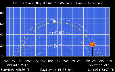
Sun Position
|
|
